Why Spurn is an ever-changing landscape

Why Spurn is an ever-changing landscape

Recently, part of the route that leads down to Spurn point has been affected by winter storms. Adam, who manages our Spurn Discovery Centre, explains how coastal erosion affects Spurn and why it will always be a moving, changing landscape.

An ever-changing place

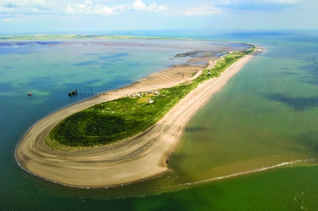
Spurn is an incredible, dynamic and ever-changing place. The piece of land that we call Spurn (or Spurn point) is a spit that separates the North Sea from the Humber Estuary.

It forms a protective barrier which stops the full force of the North Sea from going up the Humber, therefore creating a safe haven on the mud flats for wading species. It's a National Nature Reserve, owned and managed by us at Yorkshire Wildlife Trust.

How was Spurn formed?

It was formed as a result of longshore drift, which is the process by which sediment eroded by the sea is washed along the coast. Where the North Sea meets the Humber Estuary, the sediment builds up to form a peninsula made from sand and shingle.

Longshore drift is happening all of the time, so Spurn is always on the move, and always will be! This is because sea erodes it on the east (the outer side by the sea) and deposits more sediment on the west (the inner side by the estuary). This happens relatively quickly, with noticeable changes seen over years rather than decades, because the Yorkshire coast is one of the fastest eroding coastlines in the UK.

Spurn

Spurn

The 2013 tidal surge

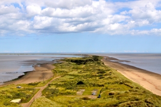
Although change is constant at Spurn, there have been some more dramatic moments. An extremely high tidal surge in 2013 washed away 1km of road and sand dune and gave Spurn the title of Britain’s newest tidal island. At high spring tides the water could now flow across the middle section of the peninsula, cutting it off from the mainland. It had gone from a peninsula that was easily accessible by road, to one that is now a walking site.

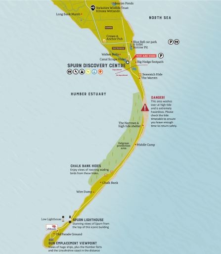
Map of Spurn

In the seven years since this happened, Spurn has done what it has always done and started the process of repairing itself. We have seen the peninsula move dramatically in the washover area (where the road used to be before it was washed over). It has moved over 50 metres towards the estuary and built up over two metres of sand dune. The new dunes have raised the level of the washover, which means it is now less frequently cut off by high tides.

We've also started to see new life growing through the dunes! This vegetation is a vital part in the natural process of creating more fixed and stable sand dunes , thus giving the peninsula stability.

Recent winter storms - what do they mean for Spurn?

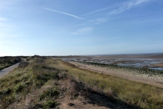
Over the past couple of weeks, Spurn has once again been affected by the winter high tides. However, the site of the 2013 washover remains stable and relatively unaffected. The focus this time has been on the very top end of the reserve where a small section of the old road has collapsed approximately 100 metres.

This is not a major problem for Spurn or Yorkshire Wildlife Trust. Fortunately, it is not a repeat of the damage we had in 2013 and is in a very localised location. 

General access remains unchanged - you can still walk down to the end and enjoy all that Spurn has to offer.  We are working to create a safe route down to the point that the Unimog and our other vehicles can use. Until this is in place, our Spurn Safaris will be cancelled, but we're offering guided walks as an alternative during this time. The clifftop path to the seawatching hide is currently impassable, and we are waiting for the end of the winter storms to identify the best new route for the future.

Yorkshire Wildlife Trust is working with (not against!) nature here at Spurn. We will forever adapting to change as we look after this fragile piece of land, especially as the effects of the climate emergency increase over the coming years.