The water levels at Denaby Ings are quite high. Please follow the footpaths to avoid flooded areas.
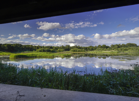
Sunset at Denaby Ings (c) Nabil Abbas

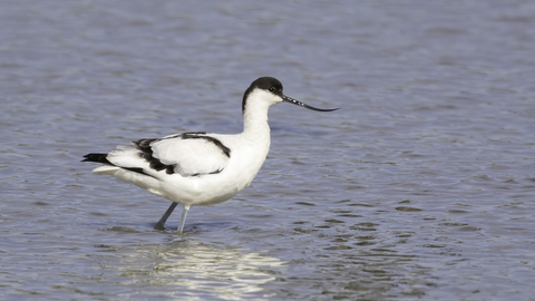
Avocet © Barry Wardley 2020

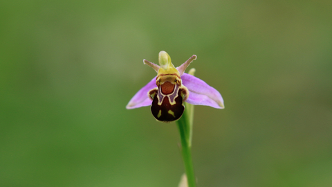
Bee Orchid (c) JudithGreaves

Spoonbill (Platalea leucorodia) feeding with water dripping from its bill, Brownsea Island, Dorset, winter. - Bertie Gregory/2020VISION
Denaby Ings Nature Reserve
Location
Know before you go
Dogs
When to visit
Opening times
Open at all times. We recommend a half day visit, but Sprotbrough Flash is very close by so why not make a full day of it?Best time to visit
August to NovemberAbout the reserve
Space to breathe
A green lung close to South Yorkshire’s urban heart, Denaby Ings is a haven for wetland and woodland wildlife, in a landscape that’s been chopped and changed many times over its history.
Even the river Dearne has changed course – the reserve sits on its old course and next to its straightened new course, and the lake was formed when the river was blocked off by tipping coal spoil from a nearby mine. Trees where herons, little egrets, great white egrets and even the odd spoonbill occasionally roost show the Dearne’s historical route. Areas of open water have formed where the river used to flow and these are now rich in aquatic life.
The raised embankment that takes you to the two hides was previously the Dearne Valley Railway, which transported coal from the local mines. The hides offer excellent views out over the main marsh and open water across to wooded crags in the distance, and great vantage points for seeing goosanders, kingfishers and other birds.
Holding back the floods
In spring and summer, the reserve fills with the sound of birdsong, and flowers, including several species of orchid, bloom in the meadows, visited by abundant butterflies.
Denaby Ings also plays an important role in flood relief. When there’s severe flooding, the river can be diverted so that water escapes into the meadows, and can be slowly released after the flood’s peak, providing a mix of reedbeds and muddy shoreline that attracts several species of wading birds, including avocets, bitterns and green sandpipers.
Contact us
Environmental designation
About
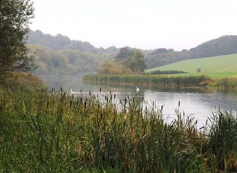
Riverside meadows, dry meadows, open water, woodland scrub and hedgerow habitats are all found at Denaby Ings and support a diverse range of species.
Grey herons sit by the river waiting to strike. In the meadows butterflies are abundant visiting the assorted wildflowers, whereas winter sees flocks of migrant birds including fieldfare and lesser redpoll.
To catch a sight of the wondrous wildlife here spend time in two of the viewing hides which overlook the main marsh and provide excellent sights over the open water of the Ings and the river valley to the wooded crags in the distance. Follow the raised embankment of the old Dearne Valley Railway to reach them. The railway, which was once used to transport coal from the local mines, is now full of the sound of birdsong during the spring and summer.
Close to the River Dearne, the site plays an important role in flood relief - the iron gates of the sluice allow water to escape into the water meadows on the nature reserve when there is severe flooding. Local volunteers and the Trust work to maintain the path and to keep open areas free from scrub. The marsh and meadows are regularly mown and grazed to maintain the habitat for a diversity of species. The water levels in the Ings are monitored and controlled to provide a mix of reedbeds and muddy shoreline attractive to the birds.
Seasonal highlights
- Spring: Birds - Avocet; Sand martin; Sedge warbler; Grasshopper warbler
- Summer: Plants - Bee orchid; Pyramidal orchid; Common spotted orchid; Reptiles - Grass snake
- Autumn: Birds - Little egret; Common sandpiper; Green sandpiper; Wood sandpiper; Redshank; Greenshank; Black-tailed godwit
- Winter: Birds - Bittern; Goosander; Siskin
History
The nature reserve has a long and varied history which can be traced as far back as Roman times, although more recently farming and coal mining has shaped the area.
Mining subsidence has caused permanent open water areas to form where the River Dearne once flowed and these are now rich in aquatic life.
The site was formed by a combination of factors. Sitting on the old course of the Dearne (the straightened new course is adjacent), the river was blocked off by tipping coal spoil from a nearby mine and a large flood gate in an old railway embankment. Thus a lake formed, and associated reedbed and fen fringe to the lake. The creation of this lake allows the silt to be used as emergency flood storage; the Dearne can be diverted along its old course to fill up the nature reserve, with water being slowly released after the peak of the flood. There are a number of fields as well, which are remnant of past land use (almost all of the other land around is now arable) and due to their long history as meadows they contain a large number of species of flowers.
Directions
Public transport
Train to Conisbrough or Mexborough from Doncaster, then approximately a 30 minute walk to the nature reserve.
By car
Denaby Ings lies north east of Mexborough. From Mexborough, take the A6023 and turn left down Pastures Road on the outskirts of the town. Follow this north east for 1 mile and then turn right into the car park shortly after crossing the River Dearne


