A Human History of Wild Ingleborough

A Human History of Wild Ingleborough

Ashes Pasture - (C) Dwayne Martindale

Dwayne Martindale, Wild Ingleborough Project Assistant, takes a look back through the human history of Ingleborough that has shaped the landscape to what it is today.

Launched in June 2021, Wild Ingleborough is an ambitious, landscape-scale project working with the community to bring about nature’s recovery in an iconic area in the heart of the Yorkshire Dales National Park, around Ingleborough – the second highest peak in the Dales.

This wide open and rugged landscape has seen drastic changes throughout history, from the glaciers of the Ice Age to the building of Ribblehead viaduct and beyond to the present day.

Humanity has certainly made its mark in this seemingly wild landscape. Farming has been present here for a considerable time, with farms being built to being left derelict as farming practices and markets have evolved with the times. Still to this day many of them still exist and continue their management of their land for food production, keeping upland farming traditions alive.

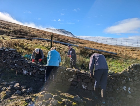
Other modern influences are also seen in the landscape here. Though many dry-stone walls are of a considerable age around Ingleborough, the introduction of the Enclosures Act led to many more being built up and down the hills and fields forming our modern boundaries and keeping them up is a craft that many people take pride in.

a group of pepople repairing a drystone wall on a sunny day up in the Yorkshbire Dales

Drystone walling (c) Dwayne Martindale

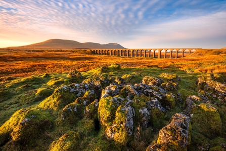
The Settle to Carlisle railway is perhaps the most impactful human influence in this landscape and certainly the enormous Ribblehead viaduct cannot be ignored, bringing tens of thousands of tourists to watch steam trains chugging over it.

Local history and heritage are important to the local community here and improved access is allowing more people to visit historical sites and becoming more educated in the people who came before us.

view of a viaduct railway bridge over the imestone pavement Yorkshire Dales with a mountain in the distance.

Ribblehead viaduct over Ingleborough (c) Shutterstock

Though the soil around the limestone areas here is relatively shallow, it contains layers and layers of history within it. Thousands of years of archaeology all contained within mere inches of soil in some places.

The nature reserves that make up Wild Ingleborough also contain valuable archaeological features and scheduled monuments, and these give us clues as to how people may have lived here during these times and their relationship to the land and nature that they would have lived amongst.

There is a human story behind Wild Ingleborough which coincides with the changes in the landscape and nature, starting thousands of years ago at the end of the last Ice Age.

Mesolithic (10,000BC – 4,000BC) to the Neolithic (4,000BC – 2,500BC)

The Mesolithic, or Middle Stone Age, begins with the complete retreat of glacial ice flow as the climatic conditions began to improve, leaving the dales and scoured limestone pavements in their wake.

Snow covered mountain and limestone pavement in the Yorkshire Dales

Twistleton Scar, Ingleborough (c) Judith Greaves

Over the few thousand years following the ice retreat the landscape would have gone over immense changes including changes in soil composition, vegetation seeding in and establishing new habitat. During this cold and dry period, bands of human hunter-gatherers would have made their way up the rivers and valleys in search of food and resources during the summer, retreating to the sheltered lowlands in the later months.

Locally, in Raven Scar Cave, brown bear bones were found close to a broken stone blade tool from this period which may indicate an interaction between a hunter and the bear, which retreated to the cave where it died of its injuries. It is hard to imagine such animals living in the caves of Ingleborough today, but we can say for certain that they did.

Around 4,000BC we begin to transition into the Neolithic and though much of this ‘New Stone Age’ would have been the same as the ‘Middle Stone Age’ there were some more permanent changes beginning to happen.

Farming in some form started around this time, and we can say for certain that Neolithic people lived here as they left behind more archaeology than their Mesolithic predecessors. Stone burial cairns and chambered cairns are found around Ingleborough containing skeletal remains, and many hut circles and wall footings can be seen on LIDAR imaging and satellite photography. We also find fragments of pottery, animal bones and flints in the area, sometimes brought to the surface in a mole hill!

These people would have shared the landscape with animals such as bears, wolves, wild boar, aurochs and elk, the latter species being good quarry for hunting meat.

Bronze Age (2,500BC - 800BC)

As we transition into the Bronze Age the climate begins to warm up and stay dry which I’m sure would have been relatively more pleasant living than the cold tundra of the Palaeolithic.

There would not have been much change in the daily lives of the Bronze Age people compared with the Neolithic apart from the gradual introduction of metalworking and material culture. Clothing made of wool replaces plant-based materials, and stone or antler-based tooling becomes more advanced with the introduction of bronze axe heads and prestigious tools or artefacts.

We begin to see more woodland clearance occurring in this period and existing glades in woodland begin to become sparser as they give way to grassland areas for crops and livestock.

Permanent residence occurs in this improving climate, and we can find brilliant examples of Bronze Age round houses that are associated with areas of land cleared of stone for agriculture.

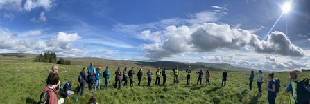
Yorkshire Wildlife Trust’s Ashes Shaw nature reserve contains a scheduled monument area with a very large round house earthwork, which can still be easily seen to this day. It is associated with a larger settlement that expanded out over the years from this feature and shows that human occupation in this wild landscape was beginning to increase on the fertile calcareous grasslands.

group of people stood in a circle in a field on a sunny autumn day

Ashes Shaw scheduled monument area. (c) Dee Lewis

The earthworks labelled ‘fort’ on the flat summit of Ingleborough also date to the late Bronze Age/Early Iron Age though it is more likely to have been a site for ritual rather than defence due to the impracticality of living and defending such an exposed site.

Iron Age (800BC-70AD)

The iron age would have seen the increasing use of iron tipped tools making labour easier for the occupants of the Ashes Shaw settlement site. The gradual introduction of tools like iron tipped ploughs that were able to turn soil over would have made for easier farming than the tools of the previous ages. Woodland clearance for livestock and crop growing continues and expands in a favourable climate, pollen records show that hemp was grown around Ingleborough during this period!

Evidence of livestock movements via drove ways can be found in the landscape to make use of seasonal pastures, such as the example we can see on Ashes Shaw. This defined track which we can still see to this day was used to help guide the people’s livestock from the limestone grassland settlement on Ashes Shaw down to the riverine pastures of the Ribble below.

Much of the settlement earthworks that we can see on the ground in Ashes Shaw today probably came from this Iron Age period, expanding out from the settlement of the Bronze age occupiers.

The people here were probably Brigantes, a collection of Celtic tribes that occupied much of the Pennines during this period, though for many of them life would be much the same as it was for the previous periods.

The coming of the Romans would bring the next shift in culture and technology.

Romano-British (70AD-410AD)

The Romans brought a great many changes to Britain. Tribal warfare, walled cities and roads to say the least and around the landscape of Ingleborough we can still see the Roman road from Cam Fell leading down through Chapel-le-Dale and on to Lancaster.

For our Ashes Shaw residents, this may have been a time of increased economic opportunity. The proximity of the Roman road would have meant travelling military units, traders and civilians, all possible opportunities for trade and commerce.

Again, for many, life would have just continued as before. Working and living on the land in a semi-wild landscape.

The end of this period sees the withdrawal of the Roman occupation and by this time the climate has begun to cool and deteriorate compared to the warm dry conditions of the Bronze and early Iron age.

Early Medieval (410AD-1066 AD)

This period is often referred to as the ‘Dark Ages’ as there are significant gaps in historical knowledge of this period and archaeology can be lacking in comparison to the pottery and stone based earthworks of the former ages.

Life after the Roman withdrawal would probably have been progressively more difficult as the climate worsened and the opportunity of trade and commerce diminished with the lack of demand.

A particularly difficult period arrived in the 530s-540s when the climate took a dramatic nosedive with a widespread effect, possibly caused by volcanic activity or a meteorite. This would have surely resulted in large scale crop failures and famine, leading to malnutrition and plague, and abandonment of the more marginal settlement sites and returning to the more fertile lands.

New kingdoms were formed by the native political elite of Britons after the Roman withdrawal, namely Elmet and Craven for the area we know today as Yorkshire.

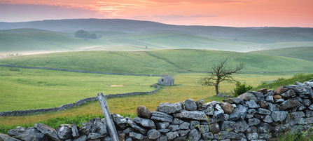
A crimson sunrise over the rolling hills of Ashes Pasture

Ashes Pasture - (C) John Potter

Following this cool period, we see a period of climatic warming. This would have been a time of booming woodland recovery in a lot of areas as the population was lower and conditions for growth were more optimal.

During this time, we see a slow progression of migration from Germanic tribes who settled in the land and began to have their own influence on this land. We know them today as the Anglo-Saxons.

Later came the Danes and Norsemen from Scandinavian lands who travelled up the river valleys and traded and brought similar influences as the Anglo-Saxons - around the Ingleborough area there are many place names with Norse or Anglo-Saxon origins which survive to this day.

The word ‘shaw’ has its origins in the Anglo-Saxon word ‘sceaga’ which translates to ‘wooded copse’. This is interesting regarding our reserve, Ashes Shaw, which indicates this site would have perhaps been more of a wooded thicket during the early medieval period. The word ‘ashes’, used in ‘Ashes Shaw’ and ‘Ashes Pasture’ reserve names, indicates a strong presence of ash trees in this area too.

Recently a settlement site believed to be dated to this period was excavated very close to Ashes Shaw on Gauber Cow Pasture, with distinctive Germanic/Scandinavian style building layouts in the rectangular long house form.

This ‘Viking Age’ came to an end with the coming of William the Conqueror and the Norman invasion, and soon after the Harrying of the North ensued. Much of the lands were given over to baronial hunting grounds and monasteries and so our small, subsistence lifestyle farmsteads on Ashes Shaw and wider Wild Ingleborough area were probably abandoned around this time and made way for the new ruling class of Norman barons and working the land for the new monasteries in the Middle Ages.

Conclusion

There is clearly lots of interesting human activity on and around the Wild Ingleborough area dating as far back as the Stone Age right through to the modern day, and it is important to remember that a wild and natural landscape, perhaps even a rewilded one, can include humans within it. We are a part of what drives Wild Ingleborough’s influence on the land today, and clearly have been living with nature here for thousands of years, through various climatic changes and cultural influences.

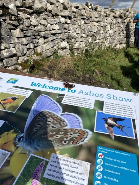
butterfly resting on an infographic board about Ashes Shaw

Welcome to Ashes Shaw (c) Dee Lewis

Ashes Shaw remains a key legacy of man’s relationship with land over the years, both in name and in its fantastic archaeology that remains to this day, within mere inches of soil. We will focus more closely on Ashes Shaw’s archaeology specifically in a later blog and hopefully this whistle stop tour of history up to the medieval period will give some context for the time periods that will be explored.

As nature recovers at Wild Ingleborough under our stewardship we continue to look into the past to inform our decisions for the future, with clues of former land uses, habitats and species still surviving in place names and earthworks, crevices and caves.

Perhaps this new era for our reserves like Ashes Shaw will be reminiscent of the time from whence it was named as a sceaga, returning to its wooded thicket roots and becoming a ‘shaw’ once more.

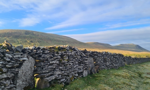
drystone wall in front of mountains on a sunny day in the Yorkshire Dales

Ingleborough 3 summits at dawn (c) Liz Coates

Help us preserve Ingleborough's wild Historic landscape

£
Type of donation